I travel through central Georgia’s Shida Kartli region almost every month on the train between Tbilisi and Kutaisi. If you’ve crossed Georgia by rail, you might know the view I mean: the wide, flat Kartli plains, fields running out towards pale, eroded hills.
I’ve looked out at this landscape countless times and always wondered what was hiding out there. This spring, I finally set aside a day to find out.
Starting from Kaspi, we headed into the badlands west of town in search of one of Georgia’s strangest and least-known archaeological sites: the Kaspi Burial Tombs.
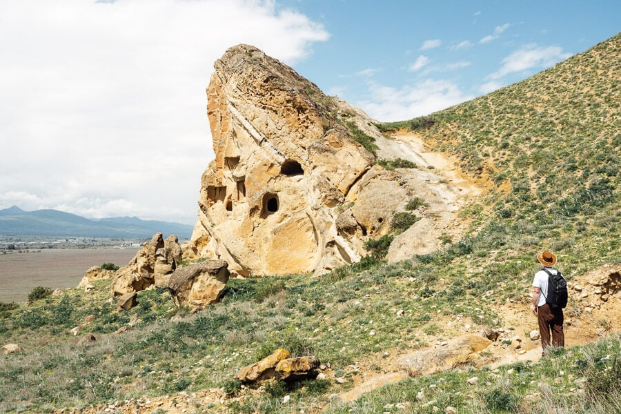
Carved into limestone cliffs above the plains, these rock-cut tombs are rather mysterious, with not much information available online. This short post brings together what I could find, along with practical tips for reaching the tombs, and other things to do in and around Kaspi.
Kaspi is an easy detour from Gori or Uplistsikhe if you have your own car, and is a fun adventure if you’re interested in wild landscapes and archaeology.
You can also combine Kaspi with an exploration of Shida Kartli’s valleys – Ateni, Rkoni and Dzama – which I’ll be covering in a separate guide soon.
Please note: This post contains affiliate links, meaning I may earn a commission if you make a purchase by clicking a link (at no extra cost to you). Learn more.
About the Kaspi Burial Tombs
The Kaspi Burial Tombs is a rock-cut necropolis used for above-ground burials. Commonly dated to the 1st-3rd centuries AD – when this part of Georgia belonged to the ancient Kingdom of Iberia (Kartli), and Christianity had not yet taken root – the tombs could represent late pagan funerary traditions.
The tombs are chamber-shaped holes of different shapes and sizes carved by hand directly into the soft limestone escarpment above the Kartli plains. Scholars believe that at least 30 once existed here, but only a handful survive today.

There is very little in the way of solid information about the tombs online. But Kaspi’s position on the Iberia cultural corridor – close to the cave city of Uplistsikhe, and not far from the old capital of Armaztsikhe and other settlements along the Mtkvari Valley – suggests the tombs probably formed part of a wider network of Late Antique settlements and sacred sites.
Visually, the site is similar in some ways to Vardzia or the Davit Gareja hermitage – but the key difference is that these were funerary caves rather than serving monastic purposes. Because of this, some sources describe the Kaspi Burial Tombs as Georgia’s only rock-cut necropolis.
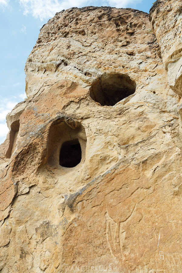
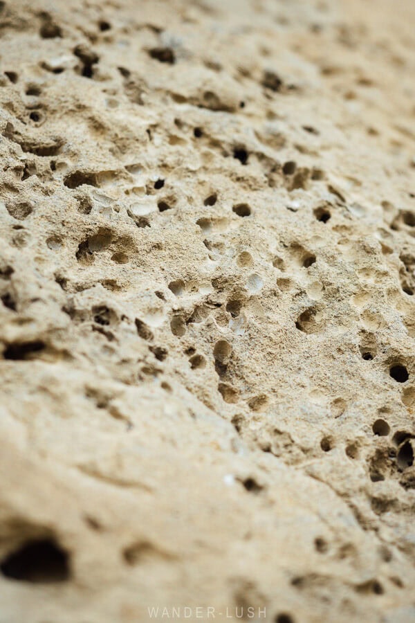
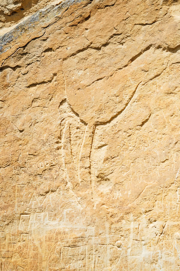
Other sources indicate the tombs may have also been used as a stopover point for people moving along a nearby trade route. A large, stylised tulip etching in the rocky wall of the main surviving tomb complex (pictured above left) could be a symbol of rebirth, commonly found across Persia and Anatolia – although it’s hard to know when exactly it was made.
This is one of those historical sites in Georgia that feels like it should be protected, but is still completely wild. The lack of documentation makes it tricky to fully appreciate the site – but there’s no denying the dramatic scenery and adventure of off-roading through the arid badlands and walking up to the tombs is more than half the experience.
Location & how to reach the tombs
The Kaspi Tombs are located along a ridge around 2.5 kilometres west of the outskirts of Kaspi, a small town between Gori and Mtskheta.
There are several points marked on Google Maps – some are incorrectly placed. The two pins you need are:
- 41°56’36.7″N 44°23’42.8″E – smaller, mound-like tombs
- 41°56’38.5″N 44°23’37.4″E – main surviving tombs (triangular rock formation when viewed from the eastern side)
If you are approaching Kaspi along the highway from the west, there are a couple of different unsealed dirt access roads that cut up through the fields towards the cliffs.
We first tried this sealed road, but it turned to dirt at the top, and we quickly discovered that it was too muddy to navigate (see tips below). If it’s dry (and you have a 4WD), you might be able to get up to this dirt track that turns west and runs all the way along the ridge to the foot of the tombs.

Otherwise, this gravel road puts you a little closer to the tombs, but it too turns to dirt/mud at some point. We drove as far as we could before continuing the rest of the way on foot – a 30-40 minute walk one-way.
After a short and very manageable ascent, you will meet the east-west dirt road, which you can follow all the way along.
You could also try taking the earlier turn-off for Tetratkhevi Monastery (what appears to be another dirt road) then approaching the tombs from the east instead.
Michael Turner has some great photographs of the tombs on his website and kindly helped me to pinpoint the exact location before I set off. Thank you again, Michael!
What to look for
Our walk took us up through fields awash with yellow wildflowers in May. Once we were above the fields and on the dirt track, the views started to open up.
Usually when I pass by this area on the train, it’s very arid. But not in spring. The fields below us were shades of soft green in May, with clusters of sheep slowly moving across the pastures, and rippling blue mountains in the distance. On the ridge opposite, one of Shida Kartli’s many windfarms. A quintessentially Kartlian landscape!
As you get closer to the tombs, you can peer back over your shoulder for a view of industrial Kaspi town – a very distinctive skyline of smoke stacks, towers and factory buildings dwarfing the cluster of Soviet-style apartment buildings that makes up the King Miriani Settlement.

As you continue west, sandstone-coloured rock formations start to appear overhead. They protrude from the sloping cliffs and poke out at strange angles. From the top of the ridge, I imagine the tombs would be almost invisible – completely embedded in the cliff, with the grassy hillside folding over them like a natural roof.
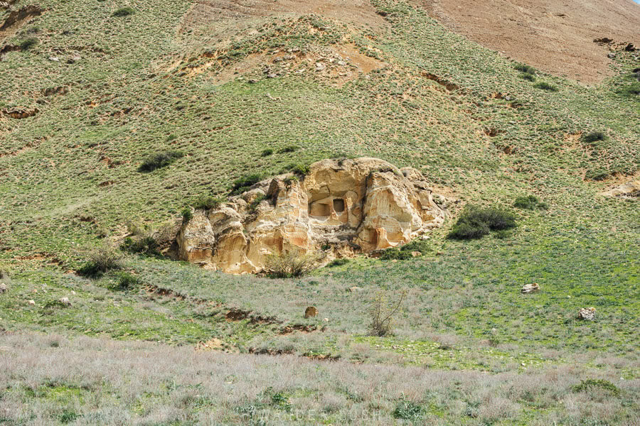
The first tombs you encounter are a small set embedded in a lower, rounded rockface pushed back in the cliff, less than 100 metres from the main tombs. Walk up here first for a nice view of the main formation floating above the fields.
There are two distinct rectangular holes cut in this rock, far enough above the ground that it’s difficult to look in. But you can tell they are quite deep. Lizards scurried across the surface of the rock, and on the ground at its feet, a couple of lone red poppy flowers.
As you get close to the triangular rock formation, it towers overhead and is punctured with at least six openings. On a flat section of stone at the bottom, a large etching of a flower – what appears to be a tulip – appears.
The rest of the rockface is covered in scratchings and graffiti as far as someone of average height could reach. On smaller rocks and stones nearby, contemporary carvings of crosses can be seen.
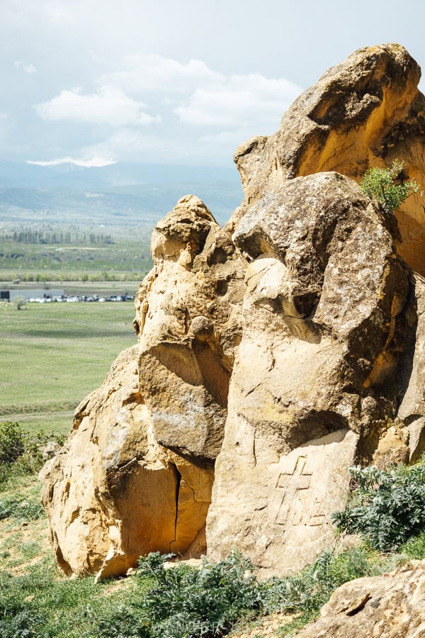
The Kaspi Tombs are reminiscent of Cappadocia, but on a much smaller scale. I was reminded of the Royal Tombs of Selca in Albania – only these tombs are much simpler, geometric holes cut without any obvious ornamentation. The tombs could easily be mistaken for a natural site rather than something carved into the landscape nearly 2,000 years ago.
Tips for visiting the Kaspi Burial Tombs
The walk to the tombs takes around 30-40 minutes depending on where you park your car. If you are coming all the way from Kaspi town, it’s closer to an hour each way. We spent about 2.5 hours at the site in total.
The walk is easy and not steep, but it’s a good idea to wear enclosed shoes to protect your feet from bugs and spiky groundcover. Remember to bring bottled water and sun protection gear with you.
It’s best to avoid visiting after heavy rain. There was just a small amount of rain the night before we visited, but it was enough to turn the roads to mud – the thick and sticky kind that congeals around your shoes and is very hard to get off. Evidently it has the same effect on car tires, and after less than a minute of driving on the dirt track (and a big sideways slide), we thought it better to walk.

The second thing to be aware of is shepherd dogs. The fields and pastures around Kaspi are used for grazing sheep in the spring and early summer, and we saw several flocks moving around in the mid-morning. The dogs that accompany them are trained to protect the animals at all costs – and after a few nasty encounters in the past, I can assure you it’s better to avoid them. We spotted three big dogs and although we could see two shepherds with them, I was still on pins and needles the entire time.
Be very wary of animals and dogs, and if you see a flock moving in your direction, try not to get too close or correct your course away from them. If a dog does come at you, keep still and yell out for the shepherd to call them off.
I would advise against visiting this area in the early morning – it’s a good idea to let the morning dew evaporate and the road dry out a bit. Visiting in the mid-morning also gives the shepherds enough time to move down into the valley.
I am always mindful of accidentally trespassing on private property (it wouldn’t be the first time I’ve done that in Georgia), but we did not see any obvious fences or signs in the area. Indeed we did not see another soul save for the shepherds in the distance. People clearly do come up here – we spotted some empty cans and other trash on the road as we were walking.
Other things to do in Kaspi
Kaspi is a lovely little town with a big history. Archaeological evidence suggests the first settlements in this area date back to the 5th century BC (with Biblical connections to Noah’s son Japheth, according to some sources). Kaspi itself evolved into a populous medieval trade city, but was later decimated by Arab invasions.
Today, the architecture in the newer part of town is almost all Soviet-era – a lot of it recently restored – with the 1931-built cement factory (formerly the I. Stalin Kaspi Cement Factory, now operating as HeidelbergCement) dominating the skyline, and the railway station anchoring the centre.
Much like the mining metropolises of Chiatura and Tkibuli, or the industrial cities of Rustavi and Zestafoni, Kaspi is something of a Soviet-era company town.
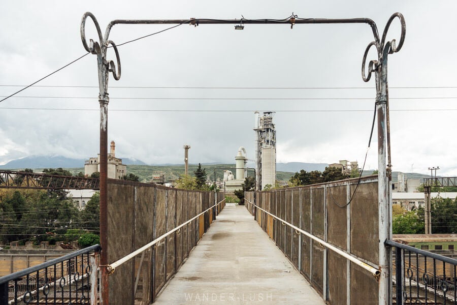
If you enjoy getting off the beaten track in Georgia, then after visiting the tombs I highly recommend sticking around for a quick walk to see a few key museums and monuments.
If you want to spend longer in this area, Chateau Mephis Kalaki in Garikula (around 20 minutes from Kaspi) is one of my favourite hotels in Georgia and a good base for a couple of nights. From there, you can easily access both Kaspi to the north-east, and the hiking trails and monasteries in the Rkoni Valley to the south-west (more below).
Kaspi Local History Museum
Most small regional museums in Georgia share a few similarities: rundown buildings, barebones facilities that do not do their collections justice at all, virtually no signage, and no or very little spoken English among the staff.
But – these museums are always worth visiting. Staff are incredibly dedicated and always eager to welcome foreign guests.

The Kaspi Local History Museum has an outstanding archaeological collection. Highlights are a statuette of Dionysus from the Kodistskaro Hoard, dated to the 1st-3rd centuries AD, and a bronze Transcaucasian axe head from nearby Zemo Rene, dated to roughly the 8th-7th centuries BC.

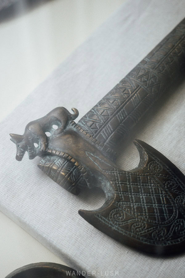
Entrance is free. There is a sign indicating the museum is closed for lunch between 1pm and 2pm, but we still found the door open.
Kaspi WWII Memorial
Located on the opposite ride of the railway tracks inside a small park, this impressive monument to the Great Patriotic War (WWII) features a giant (Kaspi?) cement fist clasping a sword emblazoned with Georgian script.


As soon as we got out of the car to photograph the monument, a man who was passing by on foot approached us and offered us a bag of apples – Shida Kartli is Georgia’s main apple-producing region, and you will see rows and rows of orchards if you drive along the opposite side of the valley.
Kaspi town: Parks & monuments
In the centre of Kaspi town, there is an impressive House of Culture – recently refaced by the looks of it – several parks and memorials. To the west of the main square, Giorgi Saakadze Park contains an equestrian statue of the Kaspi-born ‘Grand Mouravi’ who famously fought the Ottomans in the 1609 Battle of Tashiskari.

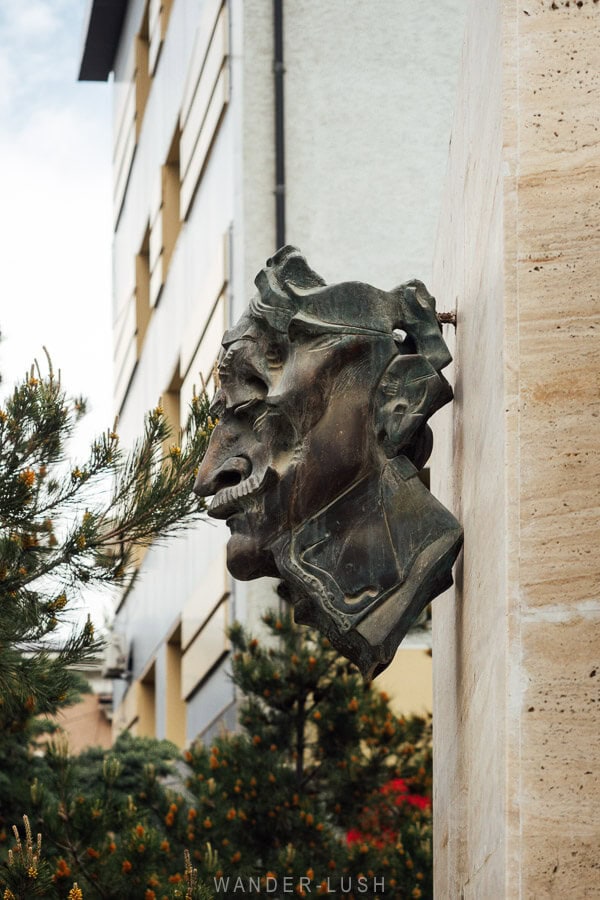
There are a couple of eateries on the square plus supermarkets – Ross grabbed lunch to go at Ditto’s Burgers and swears it was one of the best cheeseburgers he’s had in Georgia – so there you go!
Ertatsminda & the Rkoni Valley
Half an hour south-west of Kaspi, the village of Ertatsminda and the beautiful Ertatsminda Saint Estate Church marks the entrance to the Rkoni Valley. There are several valleys that cut down into the mountains of Kartli – we have also explored the Dzama Valley, while the more-famous Ateni is still on the list.

Rkoni is known for its monastery and arched Tamar Bridge, along with smaller churches such as Chachubeti. We hiked here a couple of years ago in autumn.
Graklianis Gora Archaeological Site
North of Kaspi, Grakliani Hill is one of Georgia’s most important archaeological sites, with layers of human activity spanning thousands of years. Its most famous discovery is an undeciphered inscription found on a ritual altar, often described as some of the earliest evidence for writing in Georgia. Visits to the site must be arranged in advance.
It’s a great site! When we drove there, google maps was very unhelpful. It said we could drive all the way to the first cluster of caves, which was certainly not the case. We parked and walked after the last village house(smart call in the end) Maps.me was more useful.
We missed the museum and WW2 memorial-something to do next time we are in Georgia!
Thanks for another great write-up!
Thank you, Owen! I was wondering if you’d been here. You would love the Kaspi Museum, something to come back for!