A complete first-hand guide to the Mestia Ushguli Trek – packing, transport, guesthouses, food and water, costs, and what it’s actually like on the trail.
The Mestia to Ushguli trek is Georgia’s most popular multi-day hike, and one of the best-known trekking routes in the Caucasus.
I have been to Svaneti more times than I can count. For years, though, I was perfectly content to count driving the new road from Mestia to Ushguli as my experience of this particular route. I have never considered myself a hiker, and I think I had simply decided that a four-day trek was beyond me.
That was until my friend Giga invited me to walk the route with him and another friend. How could I say no to hiking in the Greater Caucasus with two Georgians?
I prepared as best I could (i.e. raised the incline a little on the treadmill at the gym), but still set off that September morning feeling utterly underprepared. I was so nervous on the first morning of the hike, I threw up before breakfast. Yes, really!
Needless to say I am so glad I said yes to the hike. It was one of the most rewarding experiences I’ve had in Georgia, and easily one of the highlights of my year.
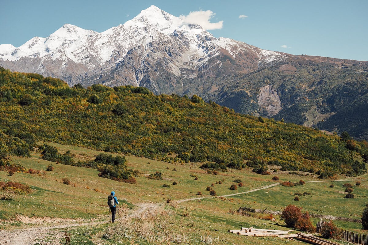
I’d be lying if I said this hike was easy. There are things I would do differently next time, things I wish I had known before setting off, and – this being Georgia – a few variables you can only prepare for as best you can.
Rather than a detailed description of the trail, this guide is about what four days hiking from Mestia to Ushguli actually feels like: The incredible landscapes and atmospheric villages, but also the road walking, the facilities, the dreaded river crossing, and all the little decisions about packing, money management and logistics that shape the experience.
These are the things I learned along the way, the mistakes I would avoid next time, and the practical details I think you should know about the Mestia to Ushguli hike.
Please note: This post contains affiliate links, meaning I may earn a commission if you make a purchase by clicking a link (at no extra cost to you). Learn more.

Mestia Ushguli trek: Our itinerary
We walked the classic route, covering roughly 58 kilometres (3,100 metres total ascent and 2,100 metres total descent) split over four days. The highest point on the hike is the Chkhunderi Pass, at approximately 2,700 metres.
It is a village-to-village trek – there is no need to camp, as each afternoon you arrive in a small Svan settlement where accommodation and meals are available in family guesthouses. Camping is also possible.
Day 1: Mestia to Chvabiani
The first day. There is a real sense of anticipation setting off from Mestia with a stream of other hikers – even if you are walking on a gravel road for the first part of the morning. The lunch spot delivers epic views, and the descent into Zhabeshi is relatively easy. |
Day 2: Chvabiani to Adishi
The short, steep day. There is a tough climb first thing in the morning as you ascend towards Tetnuldi Ski Resort, but the reward is one of the great moments of the trek: The approach to Adishi, with a sea of towers materialising beneath the mountains at the end of the day. |
Day 3: Adishi to Lalkhori
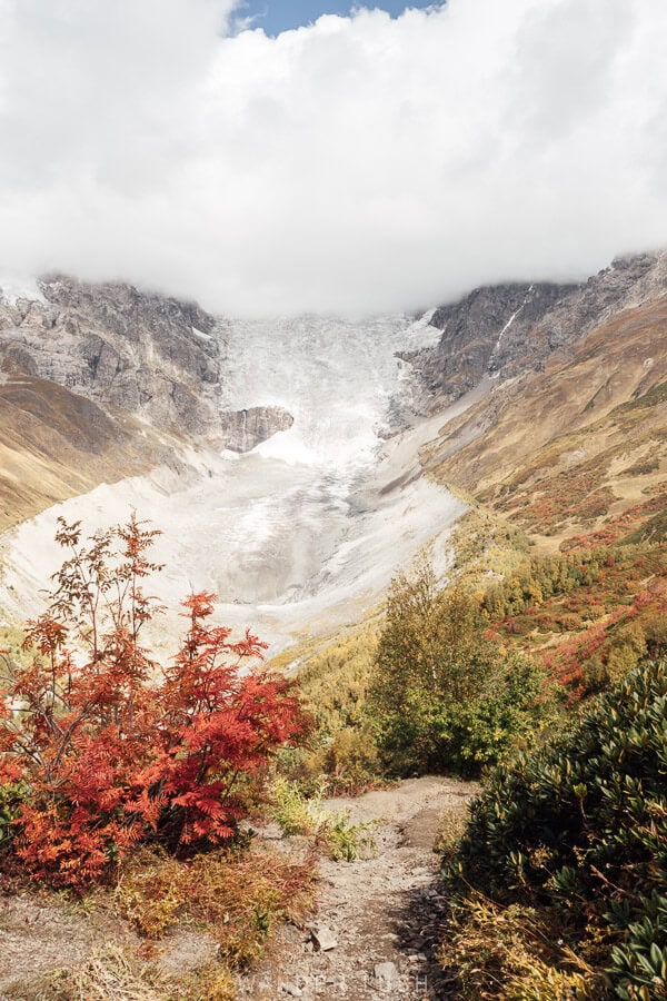
The standout day. From waking up in Adishi to getting spectacularly close to the glacier, climbing to the highest point at Chkhunderi Pass, and passing through historic Khalde – this day is the highlight reel. The flip side is the stress of the river crossing, and a long afternoon walking on tired legs. |
Day 4: Lalkhori to Ushguli
The quietest day. This leg has a reputation for being the least rewarding of the four, but it is not the slog it is often made out to be. We took the higher trail via Davberi, climbing through the forest and traversing the hillside before eventually rejoining the road for the final approach to Ushguli. |
Essential tips for hiking from Mestia to Ushguli
Think of it as four day hikes, not one four-day trek
Before I signed up for this hike, the concept of walking for four days straight felt completely beyond me. In reality, that is not really how Mestia-Ushguli feels.
Each stage is almost like a self-contained day hike (and it really helps to think of it this way): You leave one village in the morning with a clear destination in mind for the evening, and arrive with enough time to shower, eat and recover before starting again the next day. Breakfast is usually served from 8am, so there is no need for punishingly early starts either. Many people take the morning slow, so setting off before 9am is a good strategy if you want quieter trails for the first part of the day.
The pacing is pretty much perfect, with five to six hours of actual walking each day (apart from the longer Day 3), with plenty of time for lunch and rest breaks along the way.
How fit do you need to be?
I would describe this as a moderate-to-difficult trek, not a technical hike. You do not need mountaineering experience, but you should be comfortable with steep climbs and descents, uneven terrain – and doing it all again the next morning. I am not a regular hiker and would not consider myself particularly fit; I struggled on a few short sections, but overall found it very manageable.
You are never quite as remote as the scenery suggests
One of the biggest appeals of the Mestia to Ushguli trek is that it is village to village, meaning you get the satisfaction of a multi-day hike without having to carry your own food or sleep in a tent.
What I had not really considered is that villages also need road access. And where there are roads, there are cars, people, and other signs of everyday life.
At various points along the trek, you are either walking on a road or close enough to one to hear and see cars. There were definitely moments when this took some of the romance out of it – those times when my feet were sore, my shoulders aching, and a car sailed past reminding me that I could, technically, have driven.
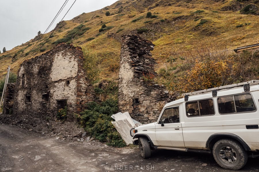
The route also passes through the Tetnuldi Ski Resort area, where you walk beneath the ropeways and other ski infrastructure. For some people, this might be a real drawback – particularly if your idea of a multi-day trek involves long stretches of true wilderness walking.
The stretch around the Adishi River and glacier and onwards towards Khalde is the only part that felt genuinely remote to me, with no road access for a substantial section. That contrast is a big part of why Day 3 was the highlight of the trek for me.
There is an upside to being closer to civilisation, though. There are small shops and cafes here and there where you can stop for a cold drink or a hot cup of herbal tea – depending on what the weather calls for.
Tapping out early or modifying the hike:
The road access also gives you options if the weather turns, you sustain an injury, or you simply decide you’ve had enough. It is possible to arrange transfers into or out of the villages, which also means you do not necessarily have to walk the full four-day route. If you only have time for one stage, I would choose Day 3: Adishi to Iprali via Chkhunderi Pass. It has the most impact and includes the river crossing, the glacier, the high pass and Khalde.
Choose the right month, but don’t obsess over the forecast
Speaking of weather, this is obviously one of the make-or-break factors on the Mestia to Ushguli trek.
The main hiking season in Svaneti runs from the start of July through to the end of September. Any earlier, and lingering ice/slush on the high pass can make conditions treacherous, while meaningful fresh snow can fall from October. Mid-June can be doable in some years, but personally I would not plan this trek any earlier than that.
July and August are the busiest months, with the warmest conditions, the most stable weather, and the largest number of hikers on the trail. September is best for cooler temperatures, fewer people, and towards the end of the month, the first autumn colours at higher elevations and around Ushguli. We hiked in late September and had close to perfect weather.
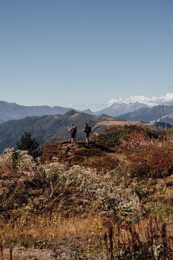

That said, mountain weather is notoriously difficult to predict. The forecasts can look positively apocalyptic several days out, only for the reality to be a short afternoon shower or an evening thunderstorm. The weather apps Yr.no and Meteoblue are generally considered to be more accurate – but even they can be way off.
Definitely use the forecast to prepare for the hike, but don’t automatically cancel because you see a little rain. Walking in light rain is going to be manageable with the right gear (proper shoes, a waterproof jacket and a pack cover – more packing tips below), but heavy rain or thunderstorms can throw you off course.
Day 3 is particularly important. You have to watch the water levels at the Adishi River crossing (more below), plus the approach and especially the descent on the Chkhunderi Pass is extremely exposed and would be a dangerous place to get caught in a storm. We had to contend with gale-force winds at the pass, and that was bad enough.
Check average temperatures for your dates:
Traileasy lets you enter your planned hiking dates and see the expected temperature range based on 20 years of historical weather data.
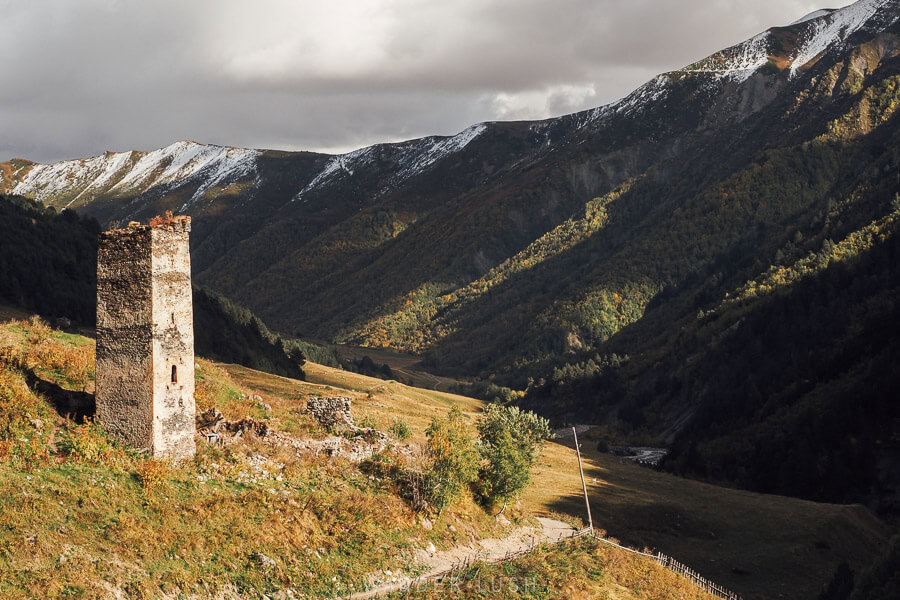
The trail is less obvious than you might think
The Mestia to Ushguli route forms part of the 3,000-kilometre Transcaucasian Trail (TCT). The Upper Svaneti section was first developed in 2016-2017, and much of the route is marked with red-and-white or yellow-and-white blazes, with occasional directional signs.
Despite its popularity, we still found the trail quite tricky to follow in places. Locating the correct way out of the village each morning can be confusing, and there are lots of junctions, side trails, farm tracks and ‘alternative routes’ to choose from. Online descriptions sometimes make things worse: Different sources suggest slightly different routes, while diversions around private property and changed conditions can make older instructions difficult to reconcile with what is actually on the ground in front of you.
There are also places where you have a choice between different routes or grades. A couple of times we inadvertently ended up on a more difficult track simply because we were following the person in front of us.
For this reason, I recommend you download each day’s route for offline navigation before leaving Mestia (or at your guesthouse – most have WIFI), rather than relying solely on trail markings. The TCT offers downloadable GPX tracks and trail notes.
I had mobile signal for pretty much the entire route, which made troubleshooting easier. Definitely go for a Magti SIM – Magti has the strongest coverage in Georgia’s mountain regions. If you are buying an eSIM, check which local network it uses before purchasing (eSIMs that run on the Cellfie network, for example, are much less reliable).
If you are hiking solo but would prefer some company, it is very easy to fall in with other hikers. Leave in the morning with the other people staying at your guesthouse, or simply start walking and you will almost certainly meet others along the way. I met several women hiking the route solo.
An interesting aside – the Mestia-Ushguli route is much more of an international hiking trail than a local one. It is not something Georgians typically seem to do – overnight hikes such as Udziro Lake in Racha are much more popular. When one of my Georgian friends hiked the route in late August, every guesthouse owner reported that she was the only local guest that year so far. And when I was walking with my Georgian friends, we were very much in the minority!
Do you need a guide?
Not necessarily. I would happily hike this route independently with an offline map. If you would rather someone else handle the navigation and logistics, guided small-group expeditions are available – Budget Georgia is one local option. Mention me when you book for 10% off.

Carrying your backpack is probably the hardest part
Pack as lightly as you possibly can for the trek. In my experience, the hiking itself is very manageable – but carrying unnecessary weight for four days is what really starts to wear you down. My backpack was under 5 kg, and even that felt like the absolute maximum I would want to carry.
Unless you arrange a porter or luggage-transfer service, you need to carry everything you bring with you for the full trek. Porter services are possible, but they are not commonplace and can be expensive.
The better option is to leave your big luggage behind in Mestia and take only what you need for the four days in a daypack. Most guesthouses will happily store your luggage for free.
What to pack:
A raincoat and backpack cover are non-negotiable. Bring plenty of sunscreen and any medications you might need (including pain and allergy meds), because replacing them once you leave Mestia can be very difficult. A powerbank and a multi-prong power adapter are also a good idea. My one comfort item was a pillowcase from home – not essential, but I was very glad I had it.
Trekking poles are essential
This is the one piece of gear I was most grateful to have with me. I had to borrow a pair from a friend (not a hiker, remember) – and by the end of the trek, after all we had been through together, it was honestly hard to let them go!
Even in good conditions, I would consider poles essential for this route. They make a huge difference on the steeper descents, in loose or muddy sections, on stream crossings, and especially on the approach (or crossing) of the Adishi River.
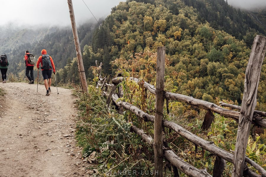
And – perhaps just as importantly – they become a kind of emotional support on the harder sections: Something to brace against or lean on when the terrain gets rough.
Can you rent hiking gear in Svaneti?
Hiking poles can be rented from shops on the main street in Mestia, but you will need to return them there. If you need boots or outdoor apparel, Ecolo in Kutaisi is a good place to look for pre-loved hiking gear. Anything specialised should be brought with you from home.
The Adishi River is the one part you cannot plan for
This is the part of the trek everyone talks about. By the time we reached Adishi, the question of horse or on foot? had become the main topic of conversation over the dinner table.
I was absolutely terrified of the crossing and had no real idea what to expect. In late September, the water was quite low (about knee-height, as you can see below), and plenty of hikers were fording it on foot. My friends, however, more or less threw me on a horse. The crossing lasted less than a minute, but it was still the most stressful moment of the entire trek – that’s right, I’m not much of a horse rider either!
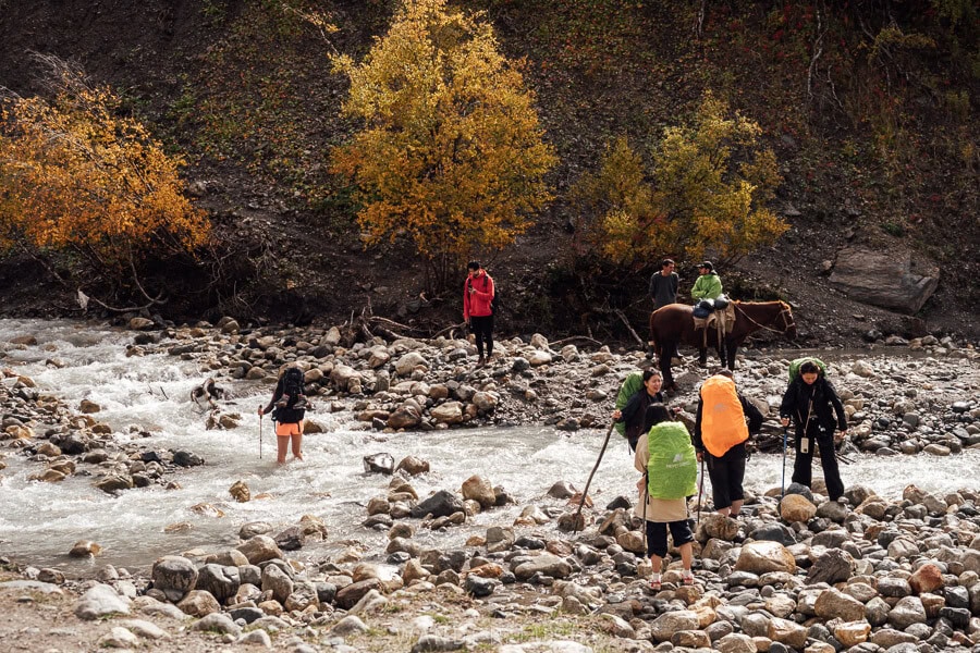
The important point here is that you should assess the river when you arrive rather than deciding how you will cross in advance. The Adishchala is fed by glacial melt, so water levels change with the season and also throughout the day. It is generally recommended to cross early in the morning, when the water is at its lowest. In early summer, crossing on foot can be difficult or impossible. I have heard of hikers having to turn back on occasion.
If you do decide to walk, scout the crossing point first. Use trekking poles for stability, expect the rocks underfoot to be slippery, and do not attempt it just because other hikers are. Bring a towel and a second pair of socks (possibly sandals or water shoes) so you can dry your feet properly afterwards. This is key because the steepest climb of the hike, up towards the Chkhunderi Pass, begins almost immediately after the river.
If the water looks too high or fast, use a horse or wait rather than forcing it. In the hiking season, local horsemen wait around the crossing in the morning from around 9am. Outside peak season or any earlier than that, you should ask your guesthouse in Adishi to organise a horse for you (for an additional cost you can hitch a ride all the way from the village, if you wish). Cash is needed to pay for the horse – see below.
Can you hike the route in reverse, from Ushguli to Mestia?
The Adishchala River is the reason most people hike from Mestia to Ushguli and not from Ushguli to Mestia. Hiking east to west means you will reach the crossing later in the day, when the water level is higher, and the horsemen have probably returned home. If you want to do the route in reverse, you need to make arrangements for the river crossing in advance through your guesthouse in Adishi.
Carry more cash than you think – including literal ‘horse money’
Once you leave Mestia, you will not be able to withdraw cash or pay for anything with card. There are no ATMs along the route (or in Ushguli), and cash is required for paying for accommodations, meals, drinks, transfers, and the river crossing.
Guesthouse pricing can be a little unintuitive. On our trek, we paid 100 GEL per person per night, including breakfast and dinner. We found that prices were sometimes calculated per person rather than per room, particularly when meals were included – so two people sharing a double room might still pay 200 GEL. Where meals are priced separately, expect roughly 30-45 GEL for breakfast or dinner.
Then there is what my friend refers to as ‘horse money’ – backup funds in case of emergency. In this case, it’s literal: If you decide to cross the Adishi River by horse, you need cash ready (20 GEL at the time of our hike).
Suggested budget for the Mestia–Ushguli trek
Based on a four-day trek, three nights on the trail, one night in Ushguli at the end, and transport from/to Kutaisi:
|
Expense |
Approx. cost pp |
Notes |
|
Guesthouses x 3 nights |
300 GEL |
Based on roughly 100 GEL pp/night including breakfast & dinner |
|
Packed lunches x 3 |
60 GEL |
Approx. 20 GEL/day |
|
Snacks |
30 GEL |
Purchased pre-hike or along the way |
|
Night in Ushguli |
150 GEL |
Including lunch, dinner & breakfast |
|
Adishi River horse crossing |
20 GEL |
Your ‘horse money’ |
|
Cash buffer |
50 GEL |
For unexpected expenses |
So for three nights on the trail plus one night in Ushguli, I would budget a total of 600-650 GEL per person, excluding transport to Mestia and onward transport from Ushguli (an additional 180-220 GEL pp total depending how you travel – see my Mestia transport guide for options).
Do you need a permit or to pay a trail fee?
No – there is no hiking permit, border-zone permission or trail/park entrance fee required for the standard Mestia-Ushguli trek. Unlike some other hiking areas in Georgia, you do not need to organise any special paperwork in advance. You should carry your passport/ID with you. Some sources recommend registering with the Mestia Tourist Information Centre on Seti Square – but this is not mandatory, and in my experience, the office is often closed when it should be open.
Villages vs communities: Choose your guesthouses carefully
Guesthouse location matters more than you might expect on this trek. In Svaneti, several individual villages can belong to the same community, and accommodation listings do not always make the distinction obvious.
Villages within the same community can be quite spread out, meaning two guesthouses that appear to be in the same area might actually be another 30-60 minutes of walking apart.
This is worth keeping in mind from the first night. Trek itineraries often refer to the Day 1 overnight stop simply as Zhabeshi, but nearby Chvabiani is another village within the same Mulakhi community, and is also a perfectly fine place to stay (better, in some ways, as it puts you closer to the Day 2 trailhead). If accommodation in Zhabeshi looks limited, widen your search to Chvabiani as well.
For Day 3, Iprali, Lalkhori, Davberi and Khalde are all villages within the wider Kala community, but they sit at different points along the route. We had a long slog along the road (in the rain) after reaching the entrance to Iprali in order to get to our guesthouse in Lalkhori.
Another option is to stop earlier in Khalde instead. This shortens the longest day of the trek and gives you a much more atmospheric overnight stay, but of course those kilometres have to be added back onto Day 4.

When I do the trek again, I will choose different places to stay in Adishi and on Day 3. These are the exact guesthouses I will book:
- Mestia: White House Nakani – Always my go-to in Mestia for its tidy rooms, amazing breakfast, and friendly host.
- Chvabiani: Maia’s Guesthouse – Tidy rooms close to the Day 2 trailhead (pictured below).
- Adishi: Gunter Guest House – Close to where we stayed with similar views, but the rooms are better-appointed and reviews are better.
- Khalde: Gaul Gavkhe Hotel – Khalde is much more atmospheric than staying beside the road around Iprali/Lalkhori.
- Ushguli: Agra – Always my go-to in Ushguli for its incredible kitchen and stylish (and warm) rooms.

It should also be said that accommodation standards are quite variable. Given how remote some of these villages are, that is not surprising – but in my experience, cleanliness was an issue at some places. Rooms are simple, bathrooms are shared – and if you’re hiking in shoulder season, it’s worth noting that guesthouses don’t have heating (warm bedding is always provided, though). Pack a warm fleece for the evenings, just in case.
Do you need to book guesthouses ahead of time?
Yes, I always would. Most properties are listed on Booking.com, so there is very little advantage to leaving it until the day. In July and August, when the trail is at its busiest, guesthouses do fill up. In the shoulder season, meanwhile, some guesthouses may be closed. After several hours of hiking, the last thing you want is to arrive in a village and have to wander around scrambling for a bed.
Guesthouse meals will feed you, but bring your own snacks
You will not go hungry on this trek, but I would not rely on guesthouse food alone to get you through the day.
Dinner is the big meal – salads, stews, vegetables, cheese, and lots of bread. Breakfast is lighter. We pre-organised packed lunches to go at each guesthouse (you should do this the night before), but those were the weak point for us: Small portions, very carb-heavy, and not much protein.


My advice is to bring a stash of protein bars, nuts, jerky or whatever hiking snacks you enjoy, and ration them for the days when breakfast is light and lunch turns out to be bread, a tomato and a single boiled egg. There are a few little shops and markets along the route, but they mainly sell chocolates, biscuits and soft drinks.
On Day 3, we arrived at our guesthouse to find the power was out across the village and dinner was delayed for two hours – I was extremely glad I still had a few protein bars in my backpack.
What about drinking water?
You do not need to carry four days’ worth of water with you. Take a decent-sized reusable water bottle (1.5-2 litres) and refill it at your guesthouse each morning. Tap water in the villages is fine to drink unless your host says otherwise. There are also streams along the route, but I would definitely filter or purify any water you collect on the trail itself.
Dogs aren’t an issue on the trail, but they can ruin your sleep
I am terrified of shepherd dogs, and they are honestly one of the main reasons I don’t do more hiking in Georgia – especially after my husband Ross was bitten by a dog in Moldova.
I had a close call myself when I hiked to Shaori Fortress in southern Georgia a couple of years ago. I was very nervous about encountering dogs on Mestia-Ushguli, but in the end we didn’t encounter a single aggressive dog – only one very friendly (retired) Caucasian dog on the trail above Ushguli. We barely saw any livestock, either – no big flocks of sheep or cattle, and therefore none of the territorial dogs that are around to guard them.
The villages were another story. Dogs barking loudly throughout the night was a serious problem (especially in Adishi) and it made getting a decent sleep really difficult.
Earplugs are almost as important as trekking poles!
The villages are a big part of the experience
Another huge perk of doing this hike is spending time in the villages. They give you a much deeper sense of the region than Mestia ever could – so don’t think of them as just convenient overnight stops, because they are part of the reason to do the trek in the first place.
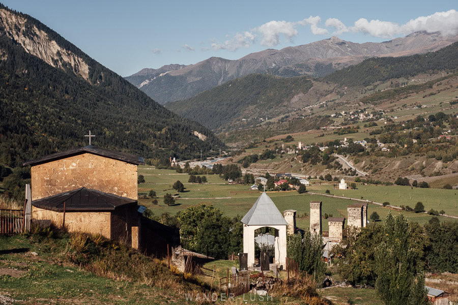
Adishi was the standout for me – and I would do the entire trek again just for that view at the entrance to the village, looking down at the towers from the ridge. Even after a full day of hiking, I could not wait to drop my bag and go back out to explore. I wandered the village until dark, photographing the towers, old houses and church while most people were recovering over drinks at the local hikers’ bar. The next morning, watching cows being milked beneath the towers in the soft light was absolutely cinematic.
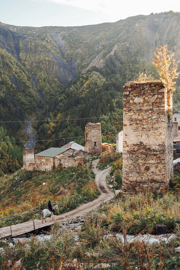
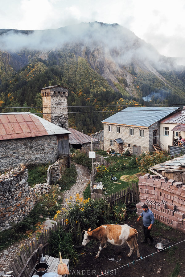
Khalde is another highlight. This village was the main stronghold of the 1875-76 Svaneti uprising against Russian imperial rule, and was ultimately captured and destroyed by Russian forces.
And of course, Ushguli is not just the finish line for the hike. After spending four days walking towards it, arriving and immediately getting into a van to return to Mestia would feel like cutting the experience short. Spend the night, go for a walk without your backpack, and give yourself time to actually enjoy the place.
Here are my suggested things to do in Ushguli, including two short hikes if you’re up for it!
The new road gives you more options for the end of the trek
On that note, finishing the hike in Ushguli no longer means you have to turn around and go straight back to Mestia. Since the road over the Zagari Pass was upgraded in 2024, it is much easier to treat the trek as a one-way journey through Svaneti and continue down through Lower Svaneti towards Kutaisi at the end.
There is no shared transport on the Zagari Pass so you will have to organise a private taxi (book with Budget Georgia and mention me for 10% off) – but it’s 100% worth it (and if you have a full car, it’s cheaper than returning with the shared transfer from Mestia).
Have your driver pick you up in Ushguli after lunch for the 4-hour drive down to Kutaisi (or all the way to Tbilisi) through Lentekhi. The Zagari Pass is open throughout the trekking season, usually until mid-October.

If you do want to return to Mestia, shared vans and taxis run back from Ushguli during the hiking season, and your guesthouse can help arrange a seat.
Luggage / car collection from Mestia:
If you want to leave from Ushguli rather than backtrack, I know a local driver who can collect your big luggage from Mestia and bring it to you. He can even arrange to transfer your rental car. Email me for his details.
What to do in an emergency
If you need mountain rescue or medical assistance on the trek, 112 is the number to call. The emergency line operates 24/7 throughout Georgia and dispatches police, ambulance and fire/rescue services. Calls to 112 are free. I also recommend downloading the 112 app, which allows you to message for help and send your location coordinates.
Travel insurance for Georgia is also essential. Since January 1, 2026, all tourists entering Georgia have been required to hold valid health and accident insurance with at least 30,000 GEL of coverage for the full duration of their stay – more details here.
For a trek like this, check the fine print carefully: Your policy should specifically cover hiking at the elevations reached on this route and, ideally, search and rescue/emergency evacuation.
All comments are moderated and may take a little while to appear. If you’ve submitted your comment, I’ve got it!